18
views
0
recommends
+1 Recommend
0 collections
    0
    shares
      • Record: found
      • Abstract: found
      • Article: found
      Is Open Access

      Geospatial Science and Point-of-Care Testing: Creating Solutions for Population Access, Emergencies, Outbreaks, and Disasters

      review-article

      Read this article at

      Bookmark
          There is no author summary for this article yet. Authors can add summaries to their articles on ScienceOpen to make them more accessible to a non-specialist audience.

          Abstract

          Objectives: (a) To understand how to integrate geospatial concepts when implementing point-of-care testing (POCT); (b) to facilitate emergency, outbreak, and disaster preparedness and emergency management in healthcare small-world networks; (c) to enhance community resilience by using POCT in tandem with geographic information systems (GISs) and other geospatial tools; and (d) to advance crisis standards of care at points of need, adaptable and scalable for public health practice in limited-resource countries and other global settings.

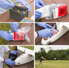
          Content: Visual logistics help integrate and synthesize POCT and geospatial concepts. The resulting geospatial solutions presented here comprise: (1) small-world networks and regional topography; (2) space-time transformation, hubs, and asset mapping; (3) spatial and geospatial care paths™; (4) GIS-POCT; (5) isolation laboratories, diagnostics isolators, and mobile laboratories for highly infectious diseases; (6) alternate care facilities; (7) roaming POCT—airborne, ambulances, space, and wearables; (8) connected and wireless POCT outside hospitals; (9) unmanned aerial vehicles; (10) geospatial practice—demographic care unit resource scoring, geographic risk assessment, and national POCT policy and guidelines; (11) the hybrid laboratory; and (12) point-of-careology.

          Value: Small-world networks and their connectivity facilitate efficient and effective placement of POCT for optimal response, rescue, diagnosis, and treatment. Spatial care paths™ speed transport from primary encounters to referral centers bypassing topographic bottlenecks, process gaps, and time-consuming interruptions. Regional GISs position POCT close to where patients live to facilitate rapid triage, decrease therapeutic turnaround time, and conserve economic resources. Geospatial care paths™ encompass demographic and population access features. Timeliness creates value during acute illness, complex crises, and unexpected disasters. Isolation laboratories equipped with POCT help stop outbreaks and safely support critically ill patients with highly infectious diseases. POCT-enabled spatial grids can map sentinel cases and establish geographic limits of epidemics for ring vaccination.

          Impact: Geospatial solutions generate inherently optimal and logical placement of POCT conceptually, physically, and temporally as a means to improve crisis response and spatial resilience. If public health professionals, geospatial scientists, and POCT specialists join forces, new collaborative teamwork can create faster response and higher impact during disasters, complex crises, outbreaks, and epidemics, as well as more efficient primary, urgent, and emergency community care.

          Related collections

          Most cited references97

          • Record: found
          • Abstract: found
          • Article: not found

          Visualization and analytics tools for infectious disease epidemiology: a systematic review.

          A myriad of new tools and algorithms have been developed to help public health professionals analyze and visualize the complex data used in infectious disease control. To better understand approaches to meet these users' information needs, we conducted a systematic literature review focused on the landscape of infectious disease visualization tools for public health professionals, with a special emphasis on geographic information systems (GIS), molecular epidemiology, and social network analysis. The objectives of this review are to: (1) identify public health user needs and preferences for infectious disease information visualization tools; (2) identify existing infectious disease information visualization tools and characterize their architecture and features; (3) identify commonalities among approaches applied to different data types; and (4) describe tool usability evaluation efforts and barriers to the adoption of such tools.
            Bookmark
            • Record: found
            • Abstract: found
            • Article: found
            Is Open Access

            Point-of-Care Diagnostics: Recent Advances and Trends

            Recent years have witnessed tremendous advances in point-of-care diagnostics (POCD), which are a result of continuous developments in biosensors, microfluidic, bioanalytical platforms, assay formats, lab-on-a-chip technologies, and complementary technologies. This special issue targets the critical advances in POCD and provides guided insights and directions for future research.
              Bookmark
              • Record: found
              • Abstract: found
              • Article: found
              Is Open Access

              Can Unmanned Aerial Systems (Drones) Be Used for the Routine Transport of Chemistry, Hematology, and Coagulation Laboratory Specimens?

              Background Unmanned Aerial Systems (UAS or drones) could potentially be used for the routine transport of small goods such as diagnostic clinical laboratory specimens. To the best of our knowledge, there is no published study of the impact of UAS transportation on laboratory tests. Methods Three paired samples were obtained from each one of 56 adult volunteers in a single phlebotomy event (336 samples total): two tubes each for chemistry, hematology, and coagulation testing respectively. 168 samples were driven to the flight field and held stationary. The other 168 samples were flown in the UAS for a range of times, from 6 to 38 minutes. After the flight, 33 of the most common chemistry, hematology, and coagulation tests were performed. Statistical methods as well as performance criteria from four distinct clinical, academic, and regulatory bodies were used to evaluate the results. Results Results from flown and stationary sample pairs were similar for all 33 analytes. Bias and intercepts were <10% and <13% respectively for all analytes. Bland-Altman comparisons showed a mean difference of 3.2% for Glucose and <1% for other analytes. Only bicarbonate did not meet the strictest (Royal College of Pathologists of Australasia Quality Assurance Program) performance criteria. This was due to poor precision rather than bias. There were no systematic differences between laboratory-derived (analytic) CV’s and the CV’s of our flown versus terrestrial sample pairs however CV’s from the sample pairs tended to be slightly higher than analytic CV’s. The overall concordance, based on clinical stratification (normal versus abnormal), was 97%. Length of flight had no impact on the results. Conclusions Transportation of laboratory specimens via small UASs does not affect the accuracy of routine chemistry, hematology, and coagulation tests results from selfsame samples. However it results in slightly poorer precision for some analytes.
                Bookmark

                Author and article information

                Contributors
                Journal
                Front Public Health
                Front Public Health
                Front. Public Health
                Frontiers in Public Health
                Frontiers Media S.A.
                2296-2565
                26 November 2019
                2019
                : 7
                : 329
                Affiliations
                [1] 1Point-of-Care Testing Center for Teaching and Research (POCT·CTR™), University of California, Davis , Davis, CA, United States
                [2] 2Knowledge Optimization® , Davis, CA, United States
                Author notes

                Edited by: Randy D. Kearns, University of New Orleans, United States

                Reviewed by: Dagan Schwartz, Ben-Gurion University of the Negev, Israel; Krzysztof Goniewicz, Polish Air Force Academy, Poland

                *Correspondence: Gerald J. Kost geraldkost@ 123456gmail.com

                This article was submitted to Disaster and Emergency Medicine, a section of the journal Frontiers in Public Health

                Article
                10.3389/fpubh.2019.00329
                6988819
                32039125
                7a2bd876-ecc6-43aa-9638-3806617265a5
                Copyright © 2019 Kost.

                This is an open-access article distributed under the terms of the Creative Commons Attribution License (CC BY). The use, distribution or reproduction in other forums is permitted, provided the original author(s) and the copyright owner(s) are credited and that the original publication in this journal is cited, in accordance with accepted academic practice. No use, distribution or reproduction is permitted which does not comply with these terms.

                History
                : 31 May 2019
                : 24 October 2019
                Page count
                Figures: 14, Tables: 1, Equations: 0, References: 114, Pages: 31, Words: 19200
                Categories
                Public Health
                Review

                demographic care unit,emergency management and preparedness,disasters,epidemics,geospatial care path™,point-of-care testing,small-world network,spatial care path™

                Comments

                Comment on this article